
Drone Construction Photography
There are many different ways in which drone construction photography can benefit a building or land development project.
Common Goals
Every Project may have unique goals and requirements for Progress Imaging. But some common benefits are:- An Accurate record over time.
- Management team collaboration.
- Off site or even out of state progress monitoring.
- Owner and investor relations.
- Lender documentation.
Why a Drone?
There are obvious benefits when using drone construction project photography.- Points of view can be at any height necessary to gather the needed image.
- Images can be repeated using GPS waypoints in order to have a consistent perspective.
- Using available cutting edge technology, a drone can repeatably fly a grid capturing a precise set of images that are processed resulting in orthorectified images and 3d surface models that can be highly accurate.
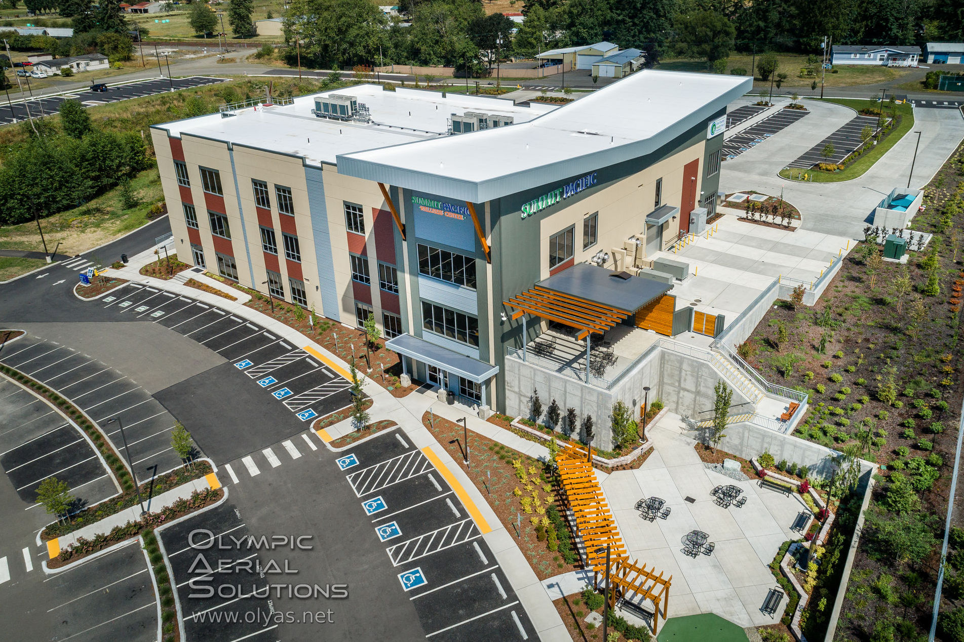
Aerial Photography; A Must Have Tool For Developers
Most of us benefit from information that is visually presented.
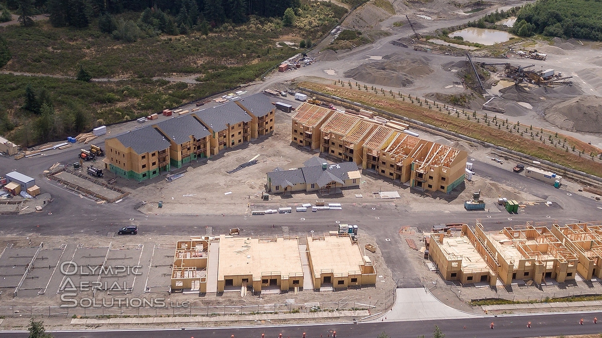
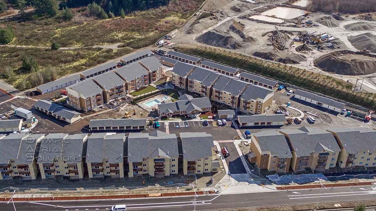
Clear communication using drone construction progress photography can be invaluable for the amount of information that can be quickly conveyed to the team.- Images can be shared with managers, owners and investors to quickly demonstrate and document development progress.
- Critical issues or potential problems can be identified and disseminated to the team quickly.
- Planning for critical tasks using high resolution imagery can reduce costly miscommunication errors and ensure team members understand the site environment early allowing them to hit the ground running.
The investment in drone captured construction project progress photography products could pay for itself many times over. Preventing one misunderstanding or mistake could be all it takes.
The value in the ability to visualize and annotate progress imagery to quickly identify and communicate project details cannot be overstated.
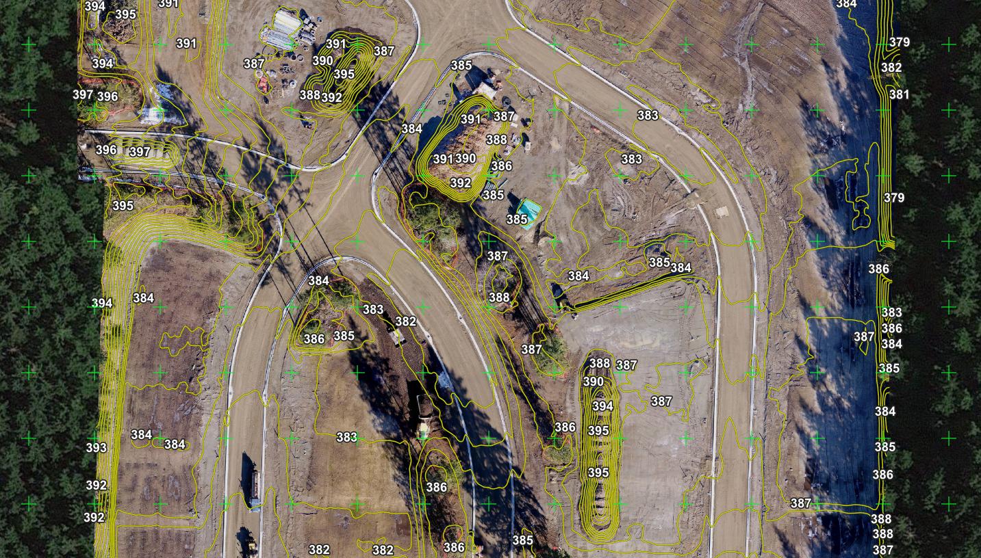
High Resolution Drone Captured Orthorectified Geo Referenced Imagery.
The following image is more than just an interesting picture. A series of images are captured from a uas (drone) and orthorectified to eliminate distortion in the resulting orthoimage.
The orthoimage is then georeferenced and can be used within GIS products, Google Earth, Google Maps, Autodesk, and other platforms. This can be an invaluable tool to quickly and accurately document project progress. Annotations and measurements can be added to imagery.
Photogrammetry derived data can be used for orthoimage overhead imagery like the example below. But it can also be used to produce 3d surface modeling including elevation profiles, material volume measurements, drainage studies, etc.
Drone Project Progress Site in Washington state.
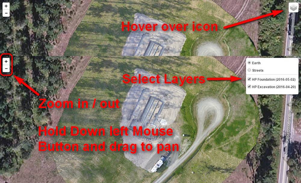
The image below is an example of an “orthoimage” presented overlaid upon a satellite image layer.
It is interactive!
Map Tips