Orthoimagery Project Example
- The image sets used to generate the orthoimagery below were shot at 200’AGL (above ground level)
- The resolution is 1″ per pixel.
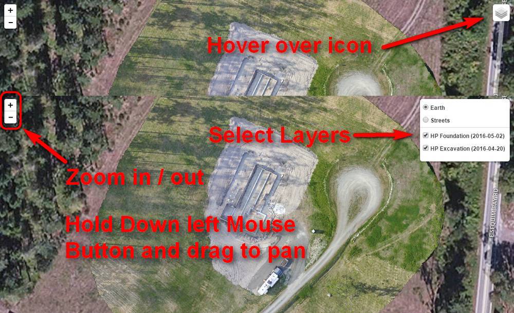
- The image tiles are dated for time of capture with the latest stacked on top. Deselect a date in the layer panel (upper right) to view the earlier image below.
- The images are georectified and presented overlaid on Open Street Maps using MapBox.