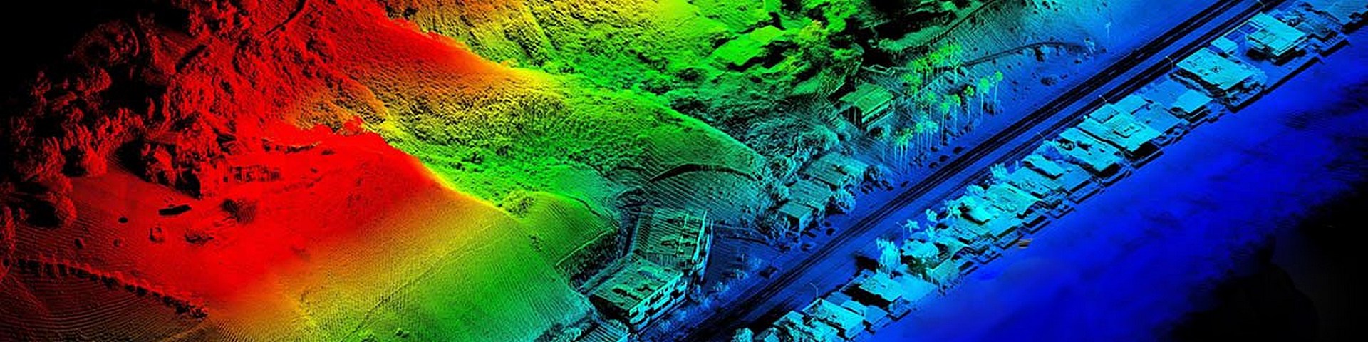
Drone Mapping, Survey and Topography
OAS is your local Washington State source for 3D spatial data commonly referred to as “drone mapping and surveying.”
Since 2015 we have been providing drone topography scanning services greatly speeding up the collection of actionable elevation and terrain data on appropriate sites.
Using RTK equipped drones, terrestrial precision gnss, and specialized Structure From Motion (SFM) computer applications, we collect data for the building of a digital 3d model of the surface.
From the 3d model of the surface we can extract topography data in many forms including high resolution orthomosaic photographs, 2d and 3d contours at specified intervals, point grids at specified spacing, 3d mesh (e.g. dxf) or TIN files, Cut & Fill Analysis, Stockpile Volume Estimates, and more.
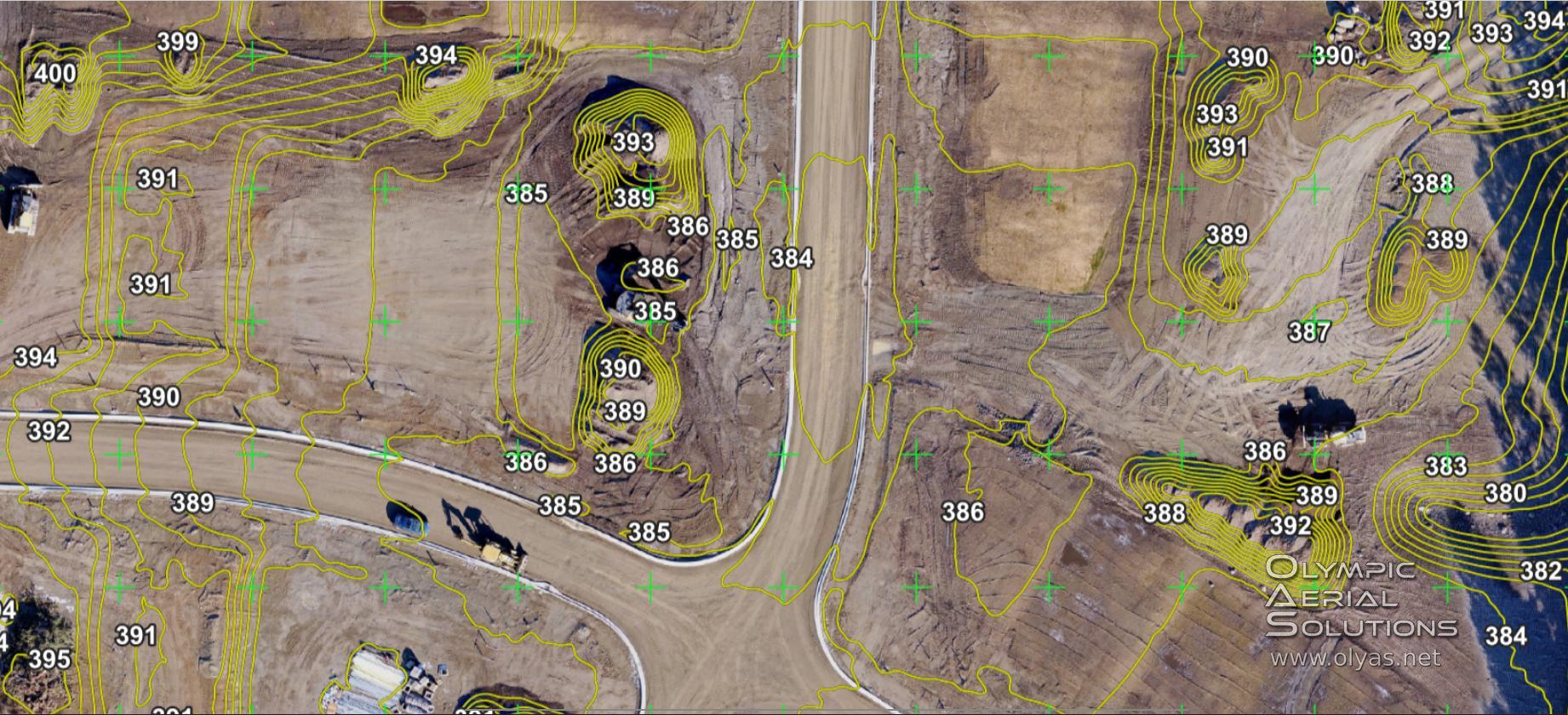
Cut and Fill
Drones change the game when it comes to getting cut and fill numbers. Being able to monitor your project’s grade development has never been easier or more affordable. There is no reason not to know exactly where you are on every project from start to finish. We can provide you with topography layers on a schedule or on demand. Take the guesswork out of critical operations.
Timely audits of existing conditions or site development progress are extremely efficient and accurate using a combination of surveyed ground control and photogrammetry techniques.
If you are interested in putting this powerful technology to work on your project, get in touch.
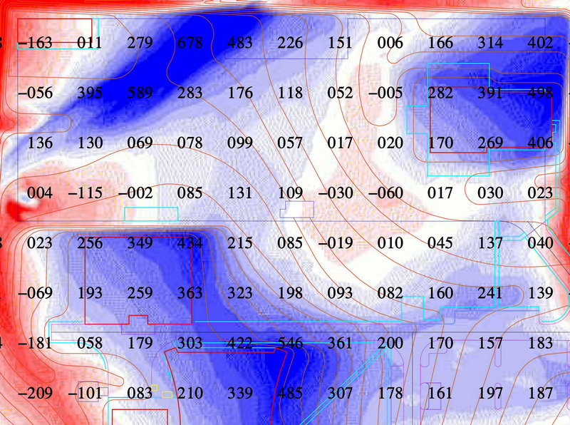
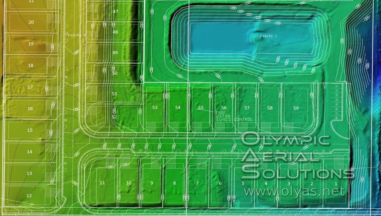
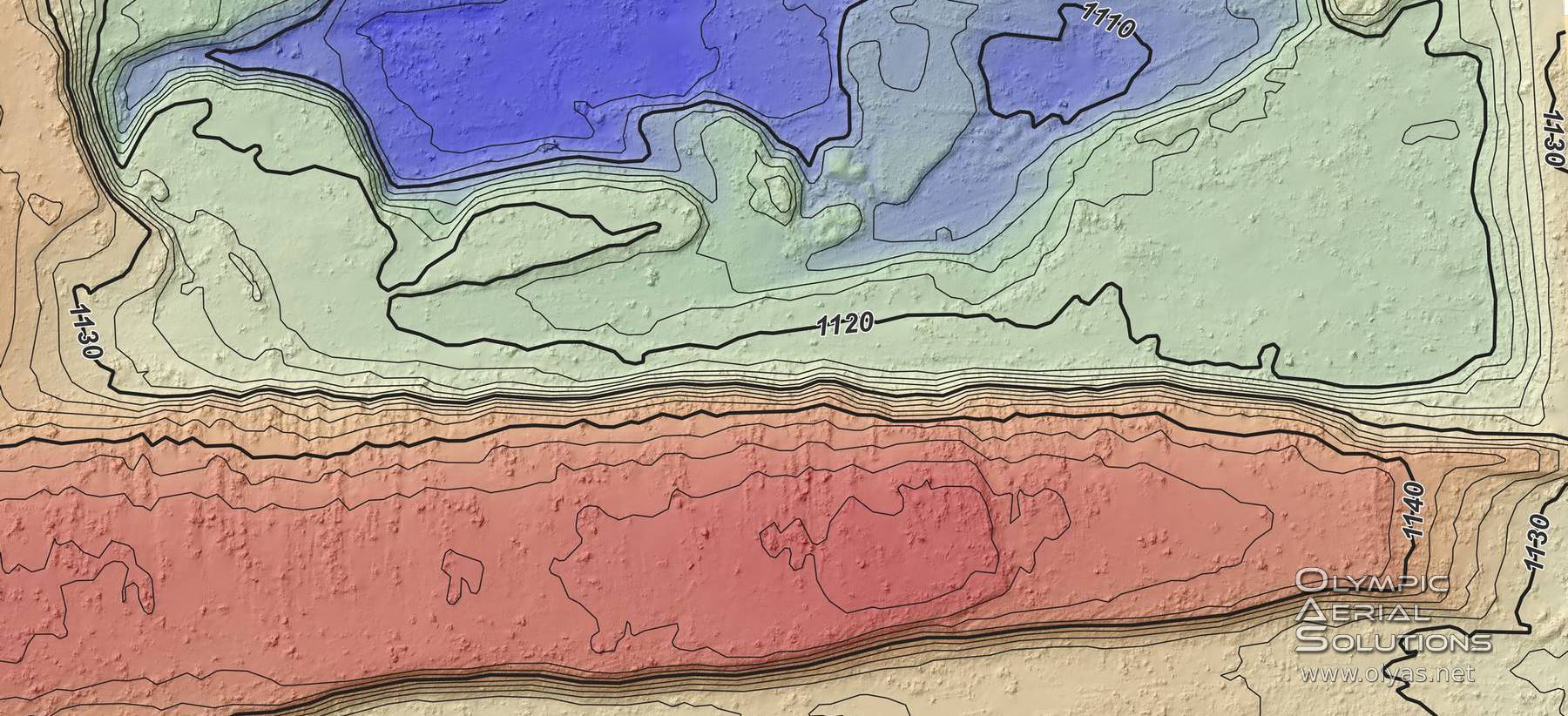
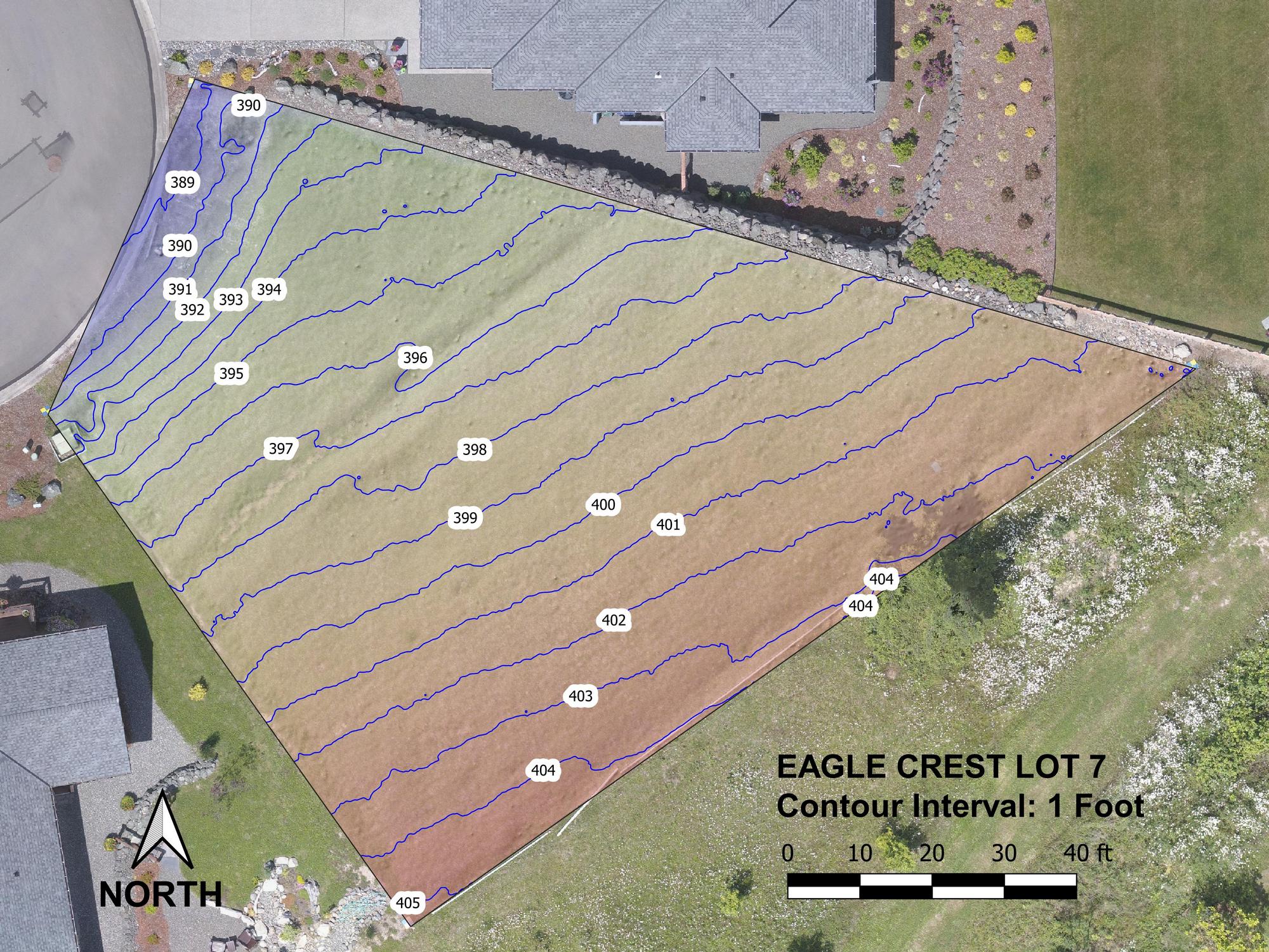
Examples Of Elevation Presentation
Topo Over Orthomosaic Image
Contours Over Elevation Heat Map
Drones and Topography
Not too far in the past, satellites or manned aircraft were required to capture data in order to create geo-referenced imagery products, putting the cost out of reach for most projects.
Today, the use of drones makes the process much more affordable, and the data can be very accurate depending on the workflow. Surface topography studies are not just for the large developer any longer. Every land owner or builder can now take advantage of detailed topography data on their project.
Actionable topographic data collection has never been so fast and affordable.
Could your project benefit from drone leveraged surface modeling?
Our clients include:
- Engineers and Survey professionals
- Land Developers and Construction companies
- Aggregate Operations
- Grading contractors
- GIS professionals and researchers
- Landscape professionals
Please Note that Olympic Aerial Solutions, LLC (OAS) is not a Washington state licensed surveyor. Topographic information provided by OAS is not under the charge of a licensed surveyor and is not meant to be used in any record, contract, or any legal purpose without the review of a licensed surveyor.
Got Questions? Ask Us!