Orthomosaic Photograph
High Resolution Drone Captured
Orthorectified Imagery
The following image is more than just an overhead picture. A series of images are captured from a uas (drone) and orthorectified to eliminate distortion in the resulting orthoimage.
The orthoimage is then georeferenced and can be used within GIS products, Google Earth, Google Maps, Autodesk, and other platforms.
This can be an invaluable tool to quickly and accurately document project progress.
The example below is an orthoimage of the Summit Pacific Medical Center in Elma, Washington layered on top of Google satellite imagery.
Photogrammetry derived data can be used for orthoimage overhead imagery like the example below. But it can also be used to produce 3d surface modeling including elevation profiles, material volume measurements, drainage studies, etc.
Drone Project Progress Site in Washington state.
The image below is an example of an “orthoimage” presented overlaid upon a satellite image layer.
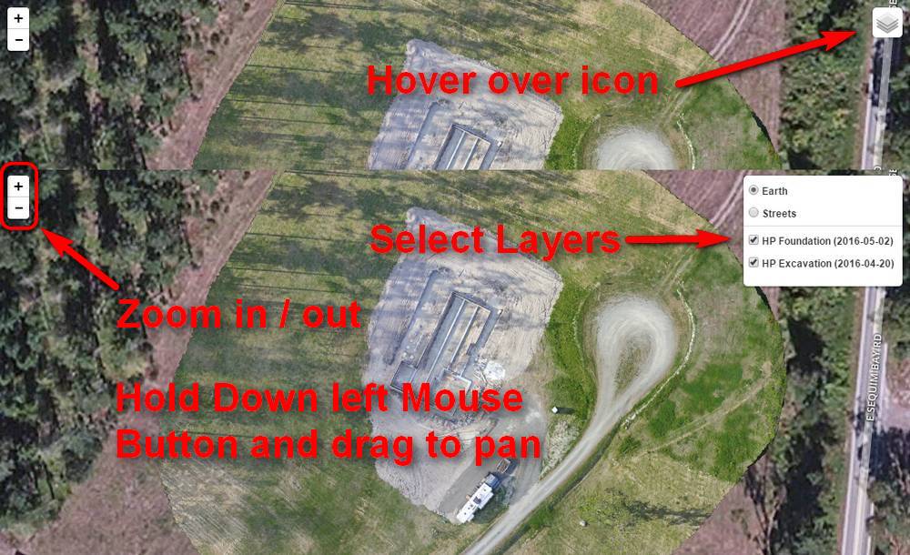
It is interactive!
Map Tips